Up to date satellite-based climate services plus equals resilience
(This article, edited slightly here for length, first appeared on the Understanding Risk website. Through the Global Framework for Climate Services – a UN initiative for the application of science-based services in climate-sensitive sectors – the Climate Centre has been advising the Tanzania Red Cross Society on incorporating climate information into decision-making.)
In recent years an increase in temporal and spatial resolution of satellite observations has afforded new lenses for climate research.
Initiatives have been established to explore the value of integrating these data into climate and weather research, increasing the understanding of climate variability, microclimates and precipitation, and more.
One persistent question remains: With technological advances in satellite engineering and subsequent gains in climate science, are gains in societal applications guaranteed?
End goal
‘Climate services’ – of which the Global Framework for Climate Services (GFCS) is the main focus – are anything that involves the production and use of climate knowledge and information in climate-informed decision-making and planning.
Arguably the most important element of the definition is action. Without action, a climate service is simply data – practically useless, regardless of its format.
A multitude of climate services have been developed to aid in assessing climate and weather risk, but are they working?
Are disaster managers better at understanding the probability of different types of floods or drought, for instance, and able to act on that information? Would acting reduce community risks to such hazards? Would such action contribute to learning and increase communities’ resilience?
While the end goal of action is consistent, the format of a climate service can vary widely: Differences could include the complexity of the data, targeted end-user, and timeliness and availability, among many others.
Humanitarian interventions
For humanitarian end-users the diversity of decision-making also necessitates a tailored set of climate services.
Building climate-resilient communities and minimizing or averting the impacts of a climate shock or weather-related disaster are examples of situations in which climate services may be used when planning humanitarian interventions.
But lacking a background in climate science, humanitarian decision-makers wonder where to start when exploring the value of climate services.
Would it be best to explore what has already been done in search of an analogue decision-making process? Perhaps it is useful to first review the many climate services that have already been developed?
Or alternatively begin with a data set that seems relevant – rainfall, for example – and work forwards from there, identifying climate services using those data and then evaluating impact.
‘Open data’
Within the emerging space of climate services, many questions exist, most without a definitive answer.
Exploring decisions and timescales, however, is considered pertinent in terms of increasing the value of climate services; the best way to do that is up for debate.
A recent application of climate services has been the utilization of ‘open data’, particularly in the context of historical climate and socio-economic data.
This data aids in understanding the interaction of the climate and society from a historical context, in turn allowing patterns to be identified, enhancing forecasts.
While data from new weather stations may increase understanding of weather, it could never take the place of historical data, especially relative to understanding past climate conditions and extreme-weather events where anecdotal evidence is also of immense value.
The amount of data derived from existing satellites and sensors increases continuously. When this is coupled with new, high-resolution products, the potential to infuse satellite technology within community-level problem-solving becomes greater.
With an increase in climate and weather risks, it is important to remember the end goal of taking action across different timescales, and with clear lines of accountability to those most in need of such services to build their resilience.
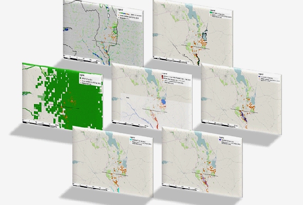
Flood monitoring maps derived from satellite-based earth observations, a selection of which were made available to disaster managers shortly after the January 2015 Malawi floods. (Library image: Helen Cen and Brigitte Moneymaker/NASA DEVELOP National Program)