‘Hurricane Beryl underscores reality of the climate crisis Caribbean island nations face’

By the Climate Centre
(Update: the IFRC Friday 5 July launched an emergency appeal worth 4.5 million Swiss francs to assist 25,000 people in Barbados, Grenada, Saint Vincent and the Grenadines and Jamaica, begun with an IFRC-DREF advance of 1.7m CHF.)
Hurricane Beryl has caused unprecedented devastation on its path across the south-east Caribbean, the IFRC Americas regional office said in a press release issued in Panama City and Geneva earlier today.
No other Category 5 North Atlantic hurricane has struck this early in the year, and it “underscores the new reality of the climate crisis that Caribbean small-island nations face: storms are more likely to rapidly intensify and become stronger, causing severe destruction and giving communities less time to recover in between shocks,” the IFRC says.
In Jamaica, the Red Cross pre-positioned supplies to all branches in anticipation of the storm’s passage, while in St Vincent and the Grenadines, Grenada, Dominica and Barbados, the Red Cross was providing life-saving assistance “despite significant challenges in accessing the affected areas, most of which are scattered and isolated”.
As of early afternoon Thursday local time, Beryl was nearing Mexico’s Yucatan Peninsula.
‘Massive devastation’
Rhea Pierre, IFRC Disaster Manager for the English- and Dutch-speaking Caribbean, said yesterday: “Hygiene kits, cleaning kits, tool kits, kitchen sets, tarpaulins, blankets and mosquito nets have already been dispatched to the hardest-hit islands …
“In the coming days, we will have a clearer picture of the full impact of Beryl on people’s physical and mental health and livelihoods. Still, rapid damage assessments show that the devastation is massive.”
The storm first affected Barbados earlier this week, causing severe damage to the south coast, damaging or destroying 200 fishing vessels.
Its eye then passed between Saint Vincent and the Grenadines, where almost all the islands’ infrastructure was damaged, and Grenada.
Beryl made landfall as a Category 4 on the Grenadian island of Carriacou as a Category 4 hurricane, damaging 95 per cent of homes; a state of emergency was called there with 3,000 people in shelters.
*
After confirmation earlier this week that TC Freddy last year was the longest-lived storm in global records, Hurricane Beryl now joins it in the history books as the earliest-ever Category 5 North Atlantic hurricane, writes the Climate Centre’s Andrew Kruczkiewicz, a lecturer at Columbia University specializing in remote sensing and early warning.
The only other case of a Category 5 Atlantic storm in July was Hurricane Emily on 16thof that month in 2005, as the National Oceanic and Atmospheric Administration confirmed on Tuesday.
Beryl’s intensity in terms of windspeed and barometric pressure is not unprecedented, but its timing is; this is very worrying, suggesting that vulnerable small-island nations may be facing an increased risk of stronger storms earlier in the year.
While the hurricane season officially starts on 1 June, early-season storm systems are historically weaker than later in the year; if strong storms like Beryl are now to be expected earlier, there will be a need to review early warning early action plans.
An additional cause for concern is that Beryl joins the ranks of destructive storms – whether they’re called hurricanes in the Atlantic, cyclones in the Indian Ocean and the Bay of Bengal, or typhoons in the South China sea – that intensified very rapidly, posing a challenge to preparedness even with the best forecasts science can provide.
It only took Beryl just over 40 hours to go from official “tropical depression” status to a major Category 3 hurricane, tripling its maximum sustained wind speed to at least 111mph or nearly 180kph.
Rapid intensification
It is very important to better understand how storm intensification may already have changed in a warming world, as an article in Nature argued last year. “Quickly intensifying tropical cyclones are exceptionally hazardous for Atlantic coastlines,” it said.
One factor clearly linked to the likelihood of intense storms – and global warming – is the temperature of the sea: broadly speaking, the warmer the sea the easier it is for meteorological depressions to suck up heat energy and become killer storms.
Across the northern hemisphere, ocean temperatures for the January to April period this year were very nearly 1.2°C above average, according to NOAA last month, and this will have applied to the waters of the south-east Caribbean.
Climate variability is also likely to have played a role with Beryl: the El Niño that has now faded would normally reduce the overall likelihood of North Atlantic hurricanes; the opposite phase, La Niña, the one we may now be entering, generally favours the development of Atlantic hurricanes.
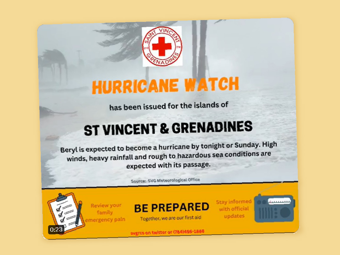
An early hurricane alert put out on Saturday, well before the storm’s passage, by the Red Cross of Saint Vincent and the Grenadines – one of the worst-affected small-island nations by Beryl, another record-breaking storm. (Image: @svgrcs)